

|
|
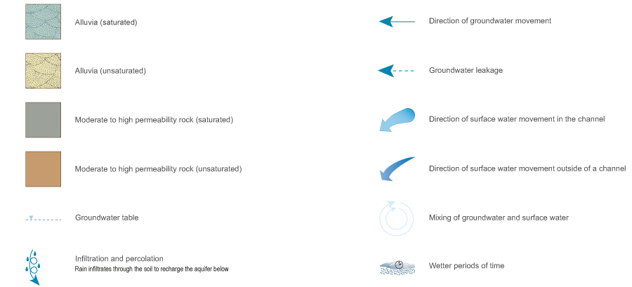
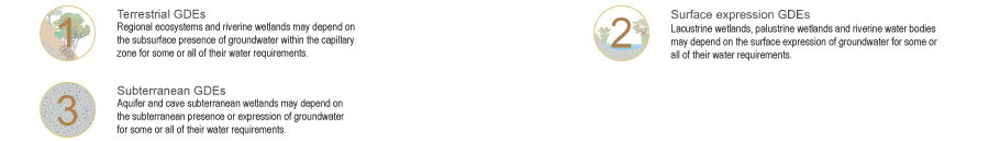
Alluvia—mid-catchmentAlluvia—mid-catchmentAlluvia—mid-catchment (wet) Click on elements of the model or select from the tabs below Alluvia in the mid catchment during wetter monthsAlluvial aquifers are formed from particles such as gravel, sand, silt and/or clay deposited by physical processes in river channels or on floodplains. Alluvia can contain one or more unconfined, unconsolidated sedimentary aquifers, where groundwater is stored and transmitted through intergranular voids between gravel and sand particles. The recharge of alluvia may occur directly (e.g. through infiltration of rainfall or inundation) or indirectly (e.g. through groundwater connection with surrounding permeable rock aquifers). During wetter months, unconsolidated sedimentary aquifers in alluvia may provide a range of ecosystems with water required to support their plant and animal communities, ecological processes and delivery of ecosystem services.
Alluvia—mid-catchment (dry)
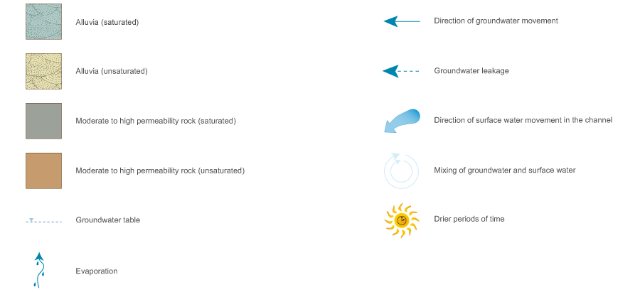
Click on elements of the model or select from the tabs below Alluvia in the mid catchment during drier monthsAlluvial aquifers are formed from particles such as gravel, sand, silt and/or clay deposited by physical processes in river channels or on floodplains. Alluvia can contain one or more unconfined, unconsolidated sedimentary aquifers, where groundwater is stored and transmitted through intergranular voids between gravel and sand particles. The recharge of alluvia may occur directly (e.g. through infiltration of rainfall or inundation) or indirectly (e.g. through groundwater connection with surrounding permeable rock aquifers). In drier months the groundwater table may drop below the surface resulting in little or no baseflow. There may be some residual pools trapped by low permeability layers beneath the channel. Unconsolidated sedimentary aquifers in alluvia may provide a range of ecosystems with water required to support their plant and animal communities, ecological processes and delivery of ecosystem services.
AlluviumAlluvium associated with channels, palaeochannels and topographic depressions may consist of various decomposed materials including, but not limited to, clay, silt, sand, gravel, cobbles, boulders or a combination thereof. Permeable geologyThe alluvium may be surrounded by permeable geological material, such as fractured rock or porous sedimentary sandstone, which contributes to the groundwater contained in the alluvium. Underlying impermeable geologyAlluvium may be underlain by a confining geological layer which separates groundwater in the alluvium from groundwater contained in a deeper confined aquifer.
Last updated: 18 December 2015 This page should be cited as: Queensland Government, Queensland (2015) Alluvia—mid-catchment, WetlandInfo website, accessed 8 May 2025. Available at: https://wetlandinfo.des.qld.gov.au/wetlands/ecology/aquatic-ecosystems-natural/groundwater-dependent/alluvia-mid/ |


Site footer

 — Department of the Environment, Tourism, Science and Innovation