Of all the desert springs, the Springvale supergroup seems to most epitomise the lure of water in a dry land, its strangeness and mystery, and also the rapidity with which the accumulated layers of natural history become obscured: the ghost springs of the pale Hamilton River flats; the forgotten weed-infested depressions where once precious water rose from the ground on vast grasslands; the tiny mud-puddles fringed by ancient human tools, now glimpsed only by passing cattle and the shadows of black kites.
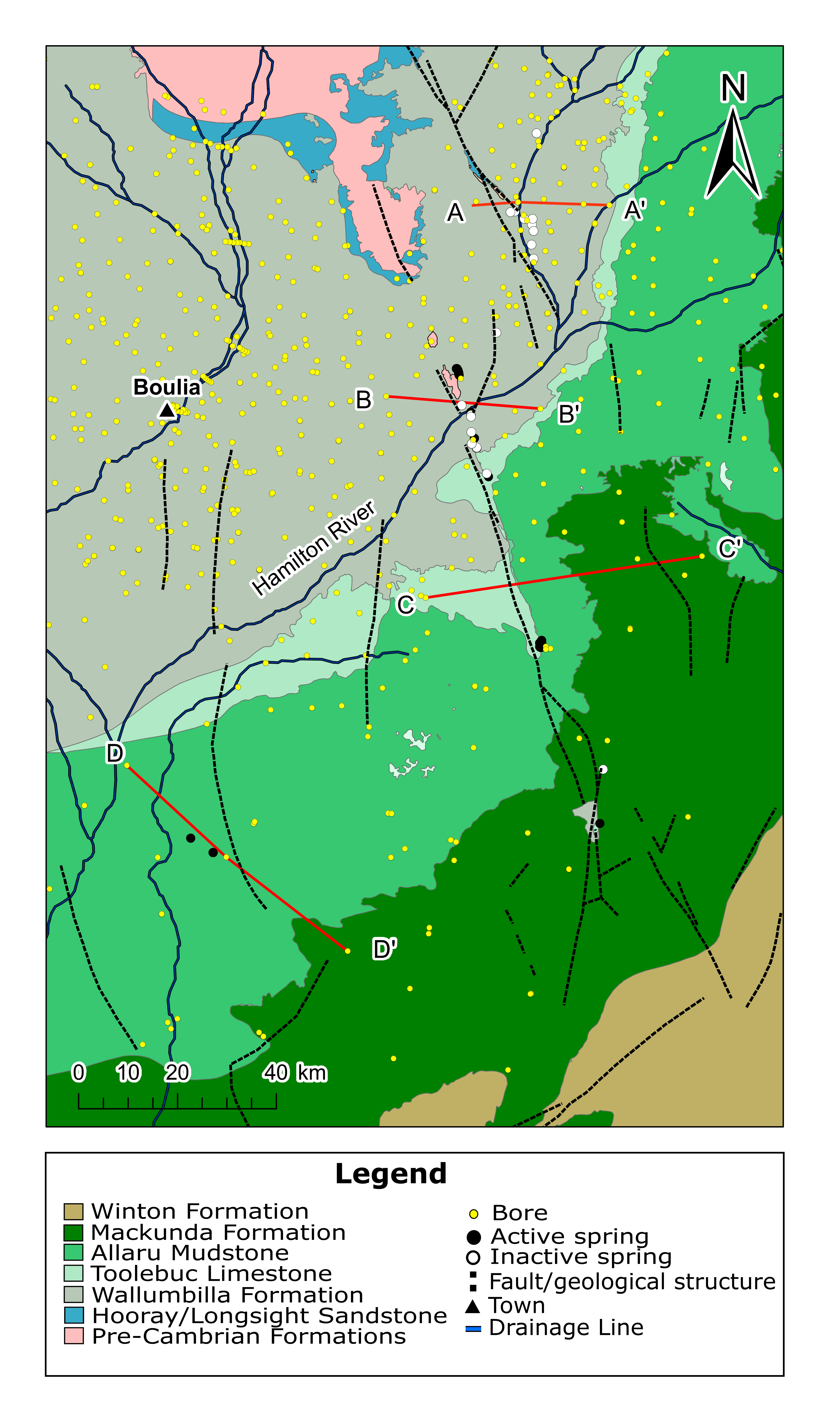
The Springvale group cover about 8000 km2 east of Boulia. The main line occurs on the alluvial plains of the Hamilton River, which flows into the Georgina. To the south, Elizabeth and Springvale springs are situated beside Spring Creek, a tributary of the Diamantina River. There are two outlying groups of small mud springs 70 km to the south-west on the vast open plains east of the Georgina River and King Creek. Eight groups of springs remain active, while 13 have become inactive including all springs north of Mt Datson.
HIDE THIS SECTION
Additional information
Section 3 Lake Eyre Basin Springs Assessment Final Report, DSITI 2015, Queensland Government, Brisbane.
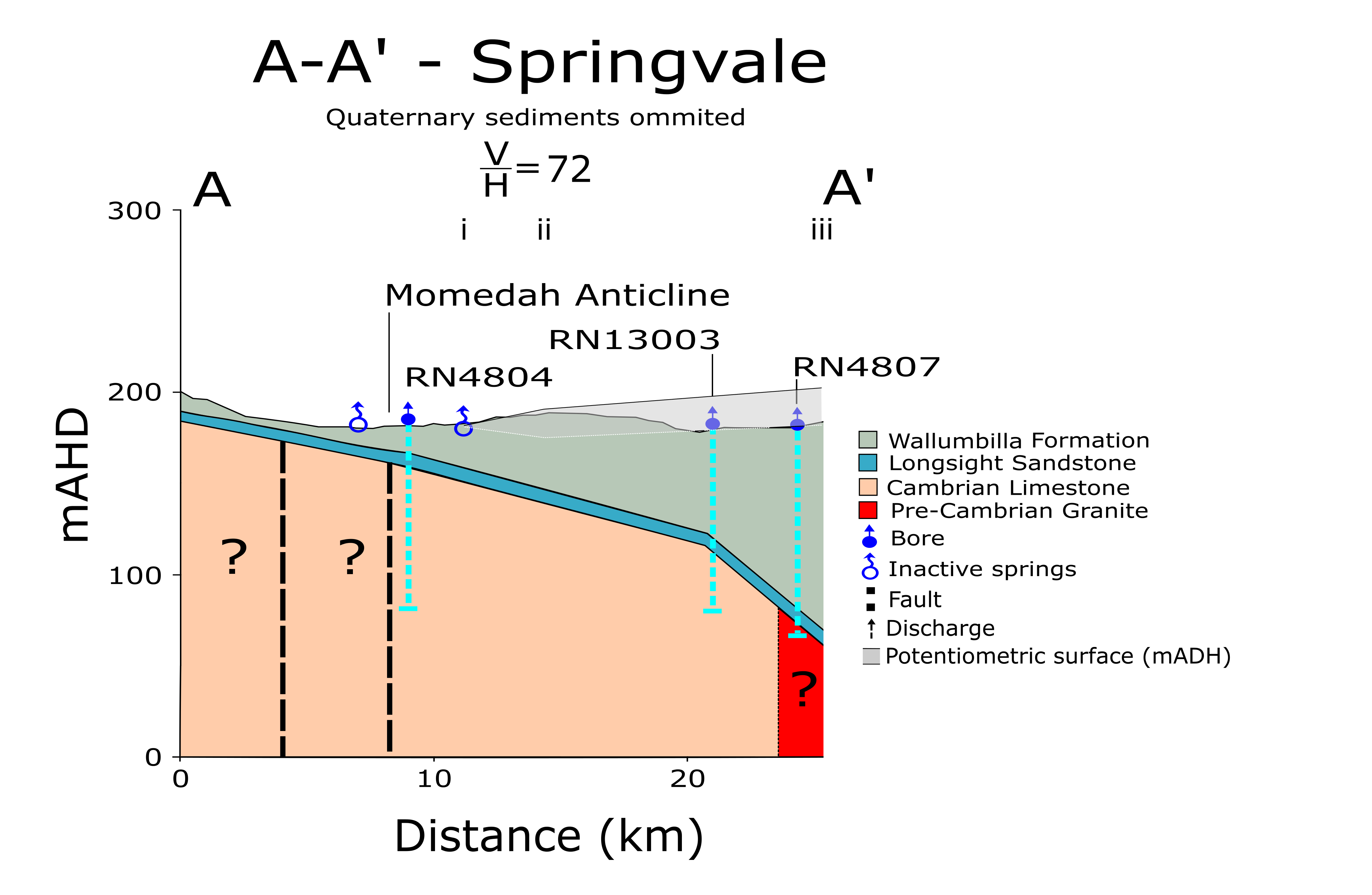
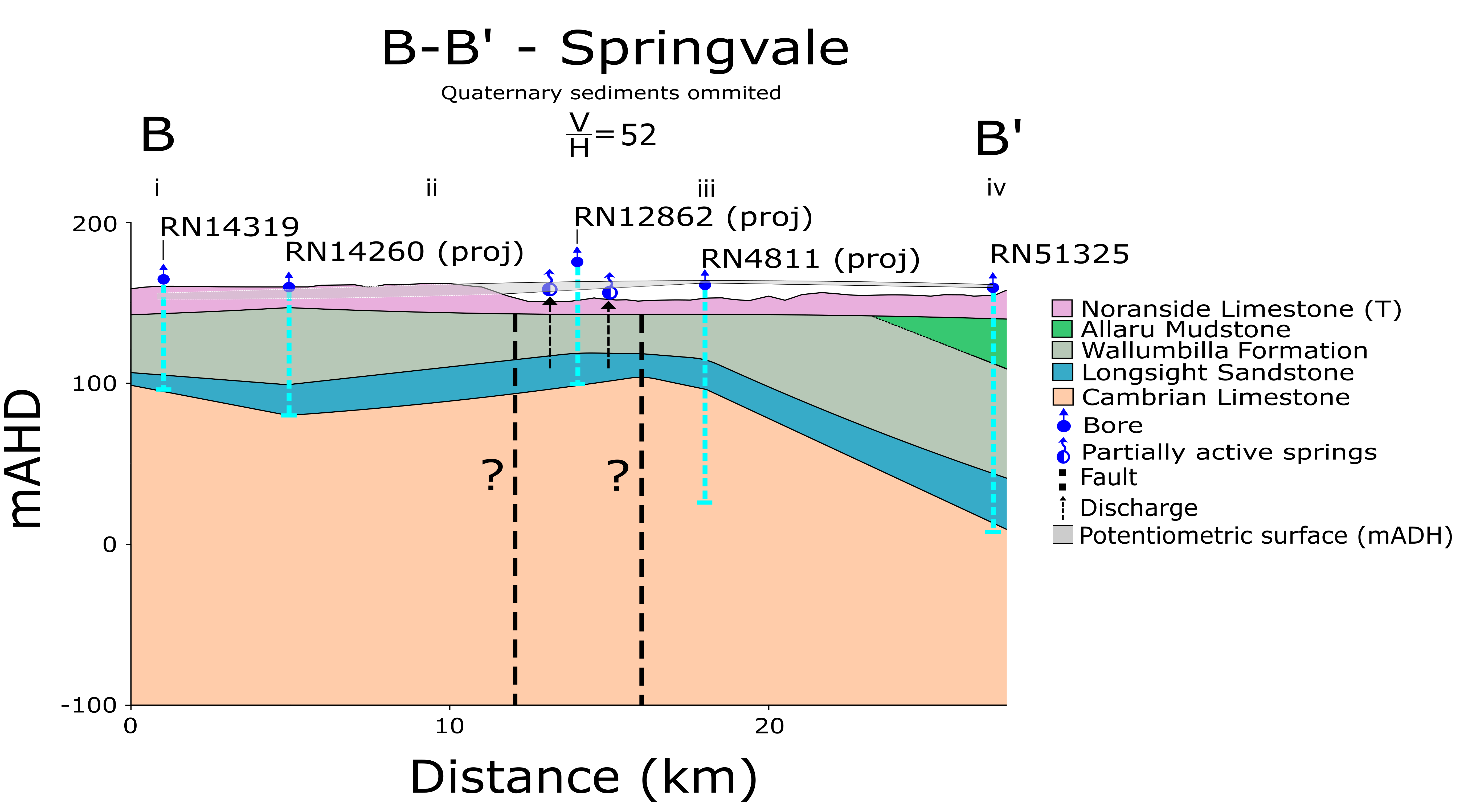
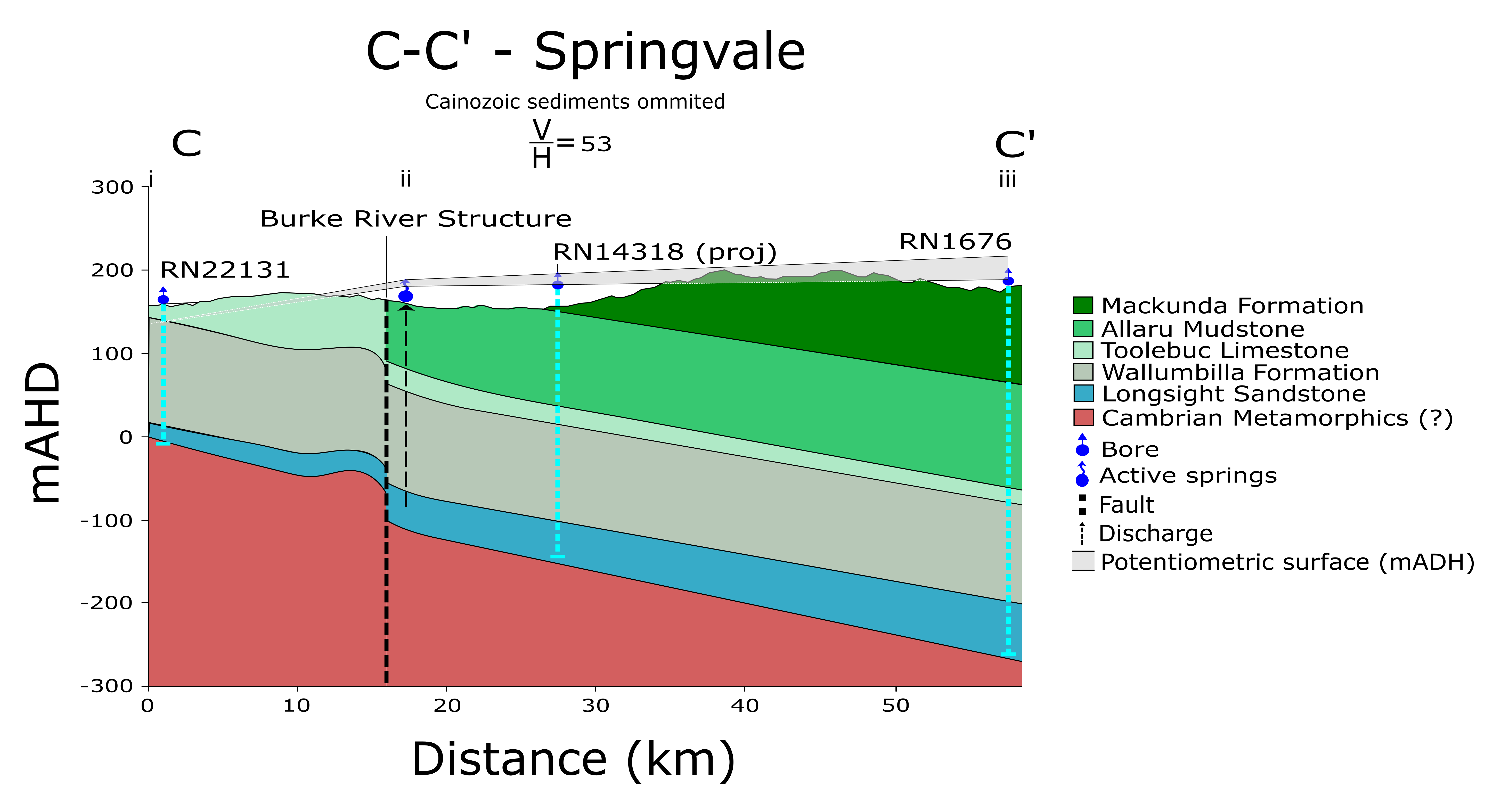
The granite basement of the Eromanga Basin in the vicinity of the Springvale supergroup is about 1000m deep. Above this basement there is a sequence of Proterozoic and Paleozoic sediments, including sandstones, shales and limestones. There is a major unconformity between these sediments and the overlying Longsight Sandstone of lower Cretaceous age. This is the main aquifer unit in the region and is overlain by a sequence of Cretaceous sediments, mostly comprised of fine-grained sediments including the Wallumbilla Formation, the Toolebuc Formation (limestone), the Allaru Mudstone and the Mackunda Formation. There are also Tertiary deposits including sandstones and limestones.
Fault structures are generally aligned north-south and probably arose in the Proterozoic. Minor movements along these structures, including the Burke River structure, during the early Tertiary have created faults and folds in the Cretaceous sediments allowing groundwater to discharge through springs.
Most of the discharge springs in this supergroup are aligned along a northerly trending fault the Burke River Structure (habermehl 1982). The fault has resulted in substantial displacement of the underlying Proerozoic and Paleozoic rocks and folded and faulted the Mesozoic sediments to the extent that groundwater discharges from the uppermost water-bearing aquifer the Longsight Sandstone (Hooray Sandstone equivalent). At Elizabeth Springs the displacement within the Longsight Sandstone aquifer appears to be in the vicinity of 30 m. Regional flows in the GAB in the vicinity of this fault structure are from the east to the west. It appears that the potentiometric surface dissipates substantially as a result of the fault.
HIDE THIS SECTION
Further information
Section 3 Lake Eyre Basin Springs Assessment Final Report, DSITI 2015, Queensland Government, Brisbane.
Last updated: 19 May 2015
This page should be cited as:
Queensland Government, Queensland (2015) Springvale Springs Supergroup, WetlandInfo website, accessed 12 April 2025. Available at: https://wetlandinfo.des.qld.gov.au/wetlands/ecology/aquatic-ecosystems-natural/groundwater-dependent/supergroup-springvale/


 HIDE THIS SECTION
 — Department of the Environment, Tourism, Science and Innovation