|
|
WetlandUpdate September 2014New WetlandUpdate formatWe are now using Mailchimp to provide you with your WetlandUpdate news. Subscribe to the WetlandUpdate newsletter. WetlandInfo website tourThis new animation shows how WetlandInfo is structured, making it easier to find the information you are looking for quickly. Demonstration on how to use WetlandMapsLearn how to use all of the tools on WetlandMaps through this animation which shows you how useful this online mapping tool can be. WetlandMaps provides an interactive map service that gives users fast and easy access to wetland information via a web-based geographic information system (GIS). The animation has also be divided into segments so that specific tools can be viewed independently. Connectivity animation narrationThe Aquatic ecosystem connectivity animation has been supplemented with a narration which provides the text to accompany the YouTube video. Conceptual modelsLake Eyre and Bulloo Freshwater Biogeographic Province:
Murray-Darling Freshwater Biogeographic Province:
Queensland Wetlands Program Strategic Management AuditThe Queensland Wetlands Program (Program) has been running for nearly 10 years and has delivered more than 70 projects. There have been three phases of the Program: Phase 1 (2003-2008), the Transitional Phase (2009-2010) and Phase 2 (2010-2013). An evaluation of Phase 1 was undertaken in 2009 by a non-government agency, while for Phase 2, a smaller management audit has been undertaken by the Department of Environment and Heritage Protection (EHP) independently of the Program. Updates, improvements and linksWetlandMapsTwo new layers have been added to WetlandMaps
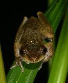
Nutrients and herbicides in groundwater flows to the Great Barrier Reef Lagoon–ReportThe Nutrients and herbicides in groundwater flows to the Great Barrier Reef Lagoon report provides an up-to-date review and synthesis of current knowledge of groundwater transport of nutrients and herbicides to the Reef, from aquifers across the Wet Tropics, Lower Burdekin and Mackay Whitsunday areas. Lake Eyre Basin Springs AssessmentThe Lake Eyre Basin Springs Assessment (LEBSA) initiative is contributing baseline information and analysis of the potential impacts of coal mining and coal seam gas developments on groundwater-dependent ecosystems in central and south-west Queensland. Literature Review of the Economic Value of Ecosystem Services that Wetlands ProvideLink to Australian Government Literature Review on the Economic Value of Ecosystem Services that Wetlands Provide. Why do fish need to cross the road? Fish passage requirements for waterway crossingsLink to Why do fish need to cross the road? Fish passage requirements for waterway crossings a NSW Fisheries guideline. This document aims to minimise impacts on fish passage and general aquatic wildlife by providing practical guidelines to those involved in the planning, design, construction and maintenance of waterway crossings. Updated tools fact sheetThe Queensland Wetlands Program tools fact sheet has been updated to include the new tools. WetlandUpdateWhen existing resources are updated or new tools are added to WetlandInfo, the WetlandUpdate newsletter is sent to subscribers with the changes featured on a What’s New summary page, now renamed WetlandUpdate. View all of the previous WetlandUpdates WetlandInfo feedback and improvementsSend us your useful wetland information and links to add to WetlandInfo. Do you have a wetland question you just can't answer? Email us Our WetlandInfo feature frog is a Litoria rheocola commonly known as the Common mist frog. WetlandInfo updates this section regularly, so keep your eyes and ears open! For more information on frogs, visit Amphibiaweb or the Frogs of Australia website. Or view species profiles in your area using the SummaryInfo search tool. Last updated: 4 September 2014 This page should be cited as: Department of Environment, Science and Innovation, Queensland (2014) WetlandUpdate September 2014, WetlandInfo website, accessed 8 May 2025. Available at: https://wetlandinfo.des.qld.gov.au/wetlands/resources/publications/latest-news/2014-08-27.html |

 — Department of the Environment, Tourism, Science and Innovation


