
Noosa River
Photo by Shane Chemello
Quick facts
- The Queensland Wetlands Program
- provides a suite of integrated tools (PDF, 0.4 MB) across the wetland management spectrum from policy and assessment through on-ground management to monitoring and communication. All these tools are freely available here on WetlandInfo.
Queensland Wetlands Program project fact sheets
Current projects
Completed projects
- Investigating Coombabah Lake and Creek, Gold Coast (PDF, 0.6 MB) and Coombabah Creek sediment and tidal study (City of Gold Coast)
- Update of the Wetlands in the Great Barrier Reef Catchments Management Strategy (PDF, 0.2 MB)
- Prioritisation of Rehabilitation and Research for Aquatic Ecosystems (PDF, 1.4 MB)
- Wetlands of Queensland: Book and online information highlighting the beauty and accessibility of Queensland's Wetlands (PDF, 1.4 MB)
- Aquatic conservation assessment of Queensland Murray-Darling Basin riverine and non-riverine wetlands (v2.0) fact sheet (PDF, 0.4 MB)
- Wetland treatment systems for nitrogen removal: a synthesis (PDF, 0.8 MB)
- Litter and Illegal Dumping Management Framework (PDF, 0.5 MB)
- Research Case Study: Recovering Australia’s migratory shorebirds (PDF, 0.5 MB)
- Intertidal and Subtidal Habitat Mapping and Conservation Values Assessment for Central Queensland State Waters (PDF, 0.3 MB)
- Research Case Study: Cost-effective restoration of wetlands that protect the water quality of the Great Barrier Reef (PDF, 0.3 MB)
- Monitoring change in wetland extent across the Great Barrier Reef catchments—2013 update (PDF, 0.1 MB)
- WATER (Wetlands in Agriculture: Training Extension and Resources) (PDF, 0.2 MB)
- Queensland Wetlands Program (QWP) Phase 3—Critical Reef Support Project (PDF, 0.1 MB)
- Wetlands and catchment management and rehabilitation in South East Queensland (PDF, 0.2 MB)
- Queensland coastal marine and estuarine habitat classification for enhanced coastal planning and management outcomes (PDF, 0.2 MB)
- Wetland management in agricultural production systems (PDF, 0.3 MB)
- Great Barrier Reef catchment wetlands risk assessment and condition monitoring (PDF, 0.3 MB)
- GDE mapping: Great Barrier Reef (Mackay–Whitsunday) (PDF, 0.2 MB)
- Freshwater fish database—inventory and database enhancement (PDF, 0.1 MB)
- Stakeholder engagement project (PDF, 0.2 MB)
- Incorporating Ramsar principles and wetland tools into park management planning (PDF, 0.2 MB)
These fact sheets have been taken down as they are out of date. If you need access please contact us on the feedback link below.
- Inland Wetlands Agriculture Training Extension and Resources (Inland WATER) project
- Enhanced management of Ramsar wetlands—Great Sandy Strait catchments
- Connectivity project Tools for decision making—Stage 1
- Ecological Character Description knowledge gaps
- Marine and estuarine habitat mapping and classification—the Wide Bay area (partially completed)
- Critical Support Guidelines
- Ecological Character Description of Ramsar sites in Queensland
- Map server and data download website
- Regional Body Wetland Census
- Scoping and developing a method for the ecological characterisation of dry tropical wetlands
- Supporting Nature Refuge Agreements in the Catchments of the Great Barrier Reef
- Understanding Queensland Wetlands: information review and gap analysis
- The Great Barrier Reef Coastal Wetlands Protection Program Pilot Program
- WetlandInfo
- Wetland Decision Support System
- Wetlands education
- Wetland Inventory Database
- Wetland Management Profiles
- Wetland Plan Development and Implementation
- Wetlands Planning and Legislation Support Tool
- Wetland rehabilitation guidelines
- Wetland Science Online
Wetland management profiles
Wetland management profiles provide information about the distribution, ecology, cultural values, conservation status, threats and management of particular wetland types and wetland regional ecosystems within Queensland.
Profiles help wetland managers identify:
- the social, economic and environmental values of wetlands
- the hydrology and ecology of wetlands
- threats and pressures on wetlands
- management actions that conserve or enhance wetland biodiversity and productivity, for example, better planning, threat mitigation and/or restoration/rehabilitation activities.
View the profiles from the list below, or use WetlandSummary—facts and maps to look for profiles within a particular area.
- Arid and semi-arid lakes (PDF, 2.0 MB)
- Arid swamps (PDF, 3.8 MB)
- Coastal and sub-coastal floodplain lakes and non-floodplain soil lakes (PDF, 3.2 MB)
- Coastal and sub-coastal non-floodplain rock lakes (PDF, 1.0 MB)
- Coastal and sub-coastal tree swamps (PDF, 2.3 MB)
- Coastal and sub-coastal wet heath swamps (PDF, 1.4 MB)
- Coastal grass-sedge wetlands (PDF, 1.3 MB)
- Coastal non-floodplain sand lakes (PDF, 2.5 MB)
- Coastal palm swamps (PDF, 2.1 MB)
- Great Artesian Basin spring wetlands (PDF, 0.8 MB)
- Karst wetlands (PDF, 0.6 MB)
- //mangrove wetlands (PDF, 1.1 MB)
- //saltmarsh wetlands (PDF, 0.9 MB)
- Semi-arid swamps (PDF, 3.1 MB)
These profiles have been taken down as they are out of date. If you need access please contact us on the feedback link below.
- Coastal fringe wetlands—cultural heritage values
- Great Artesian Basin Spring wetlands—Profile snapshot—cultural heritage values
- Great Artesian Basin Spring wetlands—cultural heritage values
To support the management profiles intertidal and subtidal seascape level ecosystem descriptions have been devised to provide a better understanding of the biological, physical and chemical attributes (factors) that are determining the nature and extent of the seascape scale ecosystems of Central Queensland.
The riverine ecosystems in Queensland have also been divided into Freshwater Biogeographic Provinces (FBPs) using broad patterns in the natural distribution of faunal communities.
Conceptual models currently exist for:
Wetland Management Profiles and other fact sheets
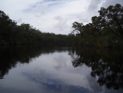
of different wetland types help wetland managers identify the social, economic and environmental values of wetlands, the hydrology and ecology of wetlands, threats and pressures on wetlands, and management actions that can be taken to conserve or enhance wetland biodiversity and productivity. These profiles link to the types identified in the mapping and classification project mentioned above.
Noosa River
Photo by Shane Chemello
Wetlands of south-western Queensland
These fact sheets have been taken down as they are out of date. If you need access please contact us on the feedback link below.
Last updated: 2 February 2023
This page should be cited as:
Department of Environment, Science and Innovation, Queensland (2023) Fact sheets, WetlandInfo website, accessed 13 April 2025. Available at: https://wetlandinfo.des.qld.gov.au/wetlands/resources/publications/fact-sheets/